


calamiac

F.Rioland
User
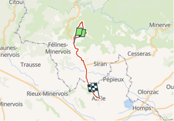

Length
14.4 km

Max alt
408 m

Uphill gradient
202 m
Km-Effort
17.6 km

Min alt
91 m

Downhill gradient
363 m
Boucle
No
Creation date :
2023-02-18 15:08:03.721
Updated on :
2023-02-18 17:05:13.858
1h49
Difficulty : Difficult

FREE GPS app for hiking
 SityTrail
IGN / Geographical institutes
SityTrail Plus
The world is yours!
About
Trail Walking of 14.4 km to be discovered at Occitania, Hérault, La Livinière. This trail is proposed by F.Rioland.
Description
rando calamiac
Positioning
Country:
France
Region :
Occitania
Department/Province :
Hérault
Municipality :
La Livinière
Location:
Unknown
Start:(Dec)
Start:(UTM)
469528 ; 4798058 (31T) N.
Comments